Temperature
U.S. National Heat Awareness Day May 31, 2024 | Winter Weather Awareness Day November 7, 2024
Winter Weather Awareness Day
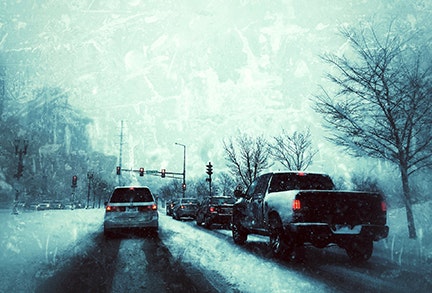
Winter Weather Awareness Day is on Thursday, November 10 in the Texas and Oklahoma Panhandles. Even though several locations across the Panhandles have already received measureable snowfall, it is a good idea to review your winter weather safety plan and prepare for extreme cold and heavy snow and even blizzards that may occur later this winter season. Since 1950, there have been more winter weather-related fatalities in the Panhandles than the combined total from lightning, tornadoes, and flash floods! A total of 70% of the winter weather-related fatalities are vehicle-related, usually where winter weather directly results in a traffic accident or from exposure to the cold once a vehicle becomes stranded.
Winter Weather Safety & Preparedness
When a winter storm impacts the Panhandles, the primary concerns include the potential for a loss of heat, power and telephone service, and a shortage of supplies if the storm continues for more than a day. It’s a good idea to keep the following supplies on hand at home:
Home Supplies & Safety Tips
- A three-day supply of water (one gallon per person, per day)
- Non-perishable food
- One change of clothing and shoes per person
- Portable radio
- Flashlight with extra batteries
- Extra set of car keys
- Cash and a credit/debit card
- Items for infants, elderly, or disable family members
- One blanket or sleeping bag
- First aid kit
- Prescription medicines
- Emergency tools
- Battery-powered NOAA Weather Radio
- Check battery powered equipment before the storm arrives.
- Check your food and have an extra supply. Include food that requires no cooking in case of power failure. If there are infants or people who need special medication at home, make sure you have a supply of the proper food and medicine.
- Be sure to practice fire prevention if you use a heat source (e.g. fireplace, stove, or space heater) at home and make sure the heat source is properly ventilated to avoid a buildup of carbon monoxide.
- Test smoke alarms and carbon monoxide detectors to ensure they work properly.
- Close off any unneeded rooms in the house, stuff towels or rags under doors, and cover windows at night.
- Don’t overexert yourself shoveling snow. Heart attacks are a major cause of death during and after winter storms.
- Dress for the conditions when outdoors. Wear several layers of lightweight, warm clothing as opposed to one heavy jacket. Layers can be removed to prevent overheating, perspiring and subsequent chill. Outer garments should be tightly woven, waterproof, and hooded. For the hands, mittens offer better protection than fingered gloves.

Vehicle Safety Tips
Get your car winterized before winter arrives. The following items should be checked: ignition system, cooling system, fuel system, battery, lights, tires, heater, brakes, wipers, defroster, oil and exhaust. Keep water out of your fuel tank by keeping it full.
If you must travel during a winter storm, it’s a good idea to follow these tips.
Check road conditions
- Avoid traveling alone, if possible.
- Let someone know your timetable and primary and alternate routes to your destination.
- Carry a winter storm kit in you car. It should include flashlight, windshield scraper, paper towels, extra clothes, matches/candles, booster cables, compass, maps, sand, chains, blankets, and high calorie non-perishable food.
- Drive carefully and defensively. Instead of slamming your breaks, pump your breaks when trying to stop on snow or ice covered roads. Roads which may appear clear in the wintertime may actually be coated with a thin layer of ice, commonly called black ice. This thin layer of can cause you to lose control of your vehicle. Reduce your speed if you detect black.
If you become stranded in your vehicle:
- Never leave your vehicle.
- Run the motor for about 10 minutes each hour for heat.
- Crack the windows for fresh air to avoid carbon monoxide poisoning.
- Be sure to keep your exhaust clear of snow if the engine is running.
- To stay warm, exercise periodically in your car by vigorously moving your arms, legs, toes and fingers.
- Tie a colored cloth (preferably red) to your antenna or door.
- After the snow stops falling, raise the hood of your car to indicate you need help.
Winter Farm Safety and Pets
- Move animals to sheltered areas.
- Shelter belts properly laid out and oriented are better protection for cattle than confining shelters, such as sheds.
- Haul extra feed to nearby feeding areas.
- Make sure pets have plenty of food, water, and shelter. Most animals die from dehydration in winter storms.
Winter Weather Watches, Warnings, & Advisories
The following tables show the criteria for the issuance of watches, warnings, and advisories for winter weather events in the Texas and Oklahoma Panhandles.
| Watch | Criteria |
|---|---|
| Freeze | Conditions are favorable for a freeze event to meet or exceed freeze warning criteria (minimum shelter temperature ≤32°F) in the next 12 to 48 hours during the growing season. |
| Wind Chill | Conditions are favorable for wind chill temperatures to reach or exceed -15°F and surface winds are expected to be ≥10 mph for at least 3 hours. |
| Winter Storm | Conditions are favorable for a winter weather event with one or more predominant hazards (below) meeting or exceeding warning criteria: |
| Winter Storm | Snow: accumulations of 6 or more inches in 24 hours. |
| Winter Storm | Sleet: an accumulation of ice pellets is expected to cover the ground to a depth of 1/2 inch or more. |
| Winter Storm | Significant public impact: defined by impact (not necessarily criteria). |
| Blizzard | Conditions are favorable for wind speeds to be ≥35 mph along with considerable falling and/or blowing snow reducing visibilities to less than 1/4 mile for at least three hours. |
| Warning | Criteria |
|---|---|
| Freeze | Minimum shelter temperatures are expected to be ≤32°F during the growing season. |
| Hard Freeze | Minimum shelter temperatures are expected to be ≤28°F during the growing season. |
| Wind Chill | Wind chill temperatures are expected to reach or exceed -15°F and surface winds are expected to be ≥10 mph for at least 3 hours. |
| Winter Storm | A winter weather event with one or more predominant hazards (below) is expected: |
| Winter Storm | Snow: Accumulations of 6 or more inches in 24 hours. |
| Winter Storm | Sleet: An accumulation of ice pellets is expected to cover the ground to a depth of 1/2 inch or more. |
| Winter Storm | Significant public impact: Defined by impact (not necessarily criteria). |
| Blizzard | Wind speeds are expected to be ≥35 mph along with considerable falling and/or blowing snow reducing visibilities to less than 1/4 mile for at least three hours. |
| Ice Storm | Damaging ice accumulations of 1/4″ or more are expected during freezing rain situations. |
| Advisory | Criteria | |
|---|---|---|
| Wind Chill | Wind chill temperatures are expected to be between -5°F and -14°F and surface winds are expected to be ≥10 mph for at least 3 hours. | |
| Winter Weather | Conditions are favorable for a winter weather event with one or more predominant hazards (below) meeting or exceeding advisory criteria but remaining below warning criteria: | |
| Winter Weather | Snow: Accumulations of 1 to 5 inches in 24 hours or less. | |
| Winter Weather | Sleet: An accumulation of ice pellets is expected to cover the ground to a depth of <1/2 inch. | |
| Winter Weather | Blowing/drifting snow: Sustained wind or frequent gusts of 25 to 34 mph accompanied by falling and blowing snow, occasionally reducing visibility to 1/4 mile or less for at least three hours. | |
| Winter Weather | Significant public impact: defined by impact (not necessarily criteria) | |
| Freezing Rain | A light accumulation (<1/4″) of freezing rain/drizzle that does not form a glaze on exposed surfaces. |